Background
The tri-hamlet peninsula of Mastic, Mastic Beach and Shirley, located on the south shore of Suffolk County, has been the focus of many planning efforts in recent years. Once predominately a summer community, the year-round population on the tri-hamlet peninsula has steadily increased since 1950 as a result of the conversion of summer homes and significant in-fill construction. Today it is the most densely populated area in the eastern portion of the Town of Brookhaven due to relatively small building lots.
Geographically, the peninsula, situated between the Great South Bay and Narrow Bay, consists of a low-lying, 100-year floodplain and is located within the Mastic-Shirley Conservation Area. The 1,685-acre Mastic-Shirley Conservation Area (shown below) was delineated in a report prepared by the Suffolk County Department of Planning entitled, “Narrow Bay Floodplain Protection and Hazard Mitigation Plan,” dated April 1997. This area is located along the southern low-lying portion of the peninsula along Narrow Bay and includes extensive tidal and freshwater wetlands where numerous vacant substandard-sized lots exist.
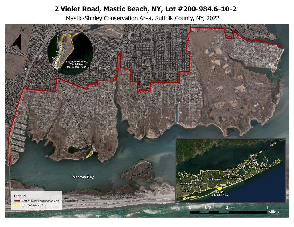
Several acquisitions within the Mastic-Shirley Conservation Area have been made by the County and Town of Brookhaven over the years. As of 2022, the County has acquired approximately 77 acres in the Conservation Area, while the federal government owns 613 acres, the State owns 93 acres, and the Town owns almost 112 acres. Altogether, about 895 acres of the Mastic-Shirley Conservation Area have been protected.
Based on 2017-2021 American Community Survey Economic data, the three Census Designated Places that make up the tri-hamlet peninsula are among the top 15 most economically distressed communities in Suffolk County with Mastic ranking #3, Mastic Beach ranking #10 and Shirley ranking #14. In addition, the New York Climate Justice Working Group recently designated three census tracts on the peninsula as Disadvantaged Communities based on 45 indicators, including Environmental and Climate Change Burdens and Risks, Population Characteristics and Health Vulnerabilities.
Violet Cove Site
Within the Mastic-Shirley Conservation Area is an approximately 1.27-acre waterfront site that was formerly occupied by the Violet Cove Restaurant. This property, the future site of the Violet Cove Redevelopment Design is located at 2 Violet Road, south of Floral Court, in Mastic Beach. The site was inundated after Superstorm Sandy and then the County seized the property for unpaid taxes. Subsequently, the County secured permits to delineate the onsite wetlands, and demolished the restaurant structure in July 2022.
The community has identified the Violet Cove Site as a key redevelopment opportunity. In recent years, there have been multiple proposed uses for the site. In recognizing that the site is in a low-lying flood prone area and building off previously provided community input, the Suffolk County Hike Bike Plan, the Suffolk County Blueway Trail Plan and the draft Southern Mastic Beach Ecological Restoration Design Project, the County is working with a design team to develop an interpretive center at the site that is connected to a larger trail network throughout the Mastic-Shirley Conservation Area. The site will focus on recreation and education relative to the natural environment and climate change. This project will also provide a new waterfront access point for the community and visitors alike.
Pursuant to this goal, Suffolk County applied for and received a $1,000,000 grant from the New York State Department of State (NYSDOS) through their Local Waterfront Revitalization Program (LWRP). These funds are being used to gather community input and feedback; evaluate potential low-impact reuse(s) for the Violet Cove Site; identify regulatory constraints and permitting to support redevelopment; develop alternatives uses and schematics for the Violet Cove Site and designs for a trail network throughout the conservation area; select a preferred alternative for the site and trail network; create interpretive signage throughout the Mastic-Shirley Conservation Area; and develop final construction documents for the selected use(s) that advance the County’s goal to improve waterfront access and promote recreation, education and environmental stewardship throughout the project area. Simultaneously, the Town, together with NYSDOS, is developing a LWRP and Harbor Management Plan for its entire south shore coastline, where the Violet Cove Site is located.
Timeline & History
1940 – Originally opened as “Captain Andy’s Fishing Station,” the Violet Cove Site most recently operated as the “Violet Cove Restaurant” and closed in 2008.
1950 – Once predominately a summer community, the year-round population on the tri-hamlet peninsula has steadily increased since 1950 as a result of the conversion of summer homes and significant in-fill construction.
1980 – Starting in the 1980s, Suffolk County acquired a significant number of wetlands and associated buffer zones within an area identified as the Mastic-Shirley Conservation Area.
1995 – The Tri-hamlet Comprehensive Plan for Mastic, Mastic Beach, Shirley was published.
1997 – The 1,685-acre Mastic-Shirley Conservation Area was delineated in a report prepared by the Suffolk County Department of Planning entitled, “Narrow Bay Floodplain Protection and Hazard Mitigation Plan”.
2012 – The Violet Cove Site was heavily damaged by Superstorm Sandy and was subsequently seized by Suffolk County for unpaid taxes.
2014 – A report by New York Rising identified the Violet Cove Site as a potential centerpiece of economic development in Mastic Beach. The report also noted that any redevelopment would have to withstand future storms.
2015 – Suffolk County Comprehensive Master Plan 2035 – Framework for the Future
Outlines specific priorities for the County to work towards. Several priorities in the plan relates to Violet Cove such as “Protecting the Region’s Environment,” “Building for Resiliency,” “Optimizing Open Space Investments,” and “Acquiring Properties for Open space and Preservation”.
2017 – Draft Mastic Beach Comprehensive Plan; Mastic Beach and Smith Point of Shirley Stormwater Management Plan Report
2019 – Suffolk County adopted Resolution Number 907-2019 which states that the Violet Cove property should be used for community purposes and not open space preservation.
2020 – Hike/Bike Master Plan Released
2022 – RFP issued for redevelopment of Violet Cove. nArchitects was selected as the consultants for this phase of the project; Draft Mastic Beach Conservancy - Our Vision for Violet Cove was published; and the structure at 2 Violet Road was demolished. Brookhaven Town Announces Local Waterfront Revitalization Program (LWRP).
2023 – Suffolk County Blueway Trail Plan is finalized.
ONGOING – Town of Brookhaven Southern Mastic Beach Ecological Restoration.
Images
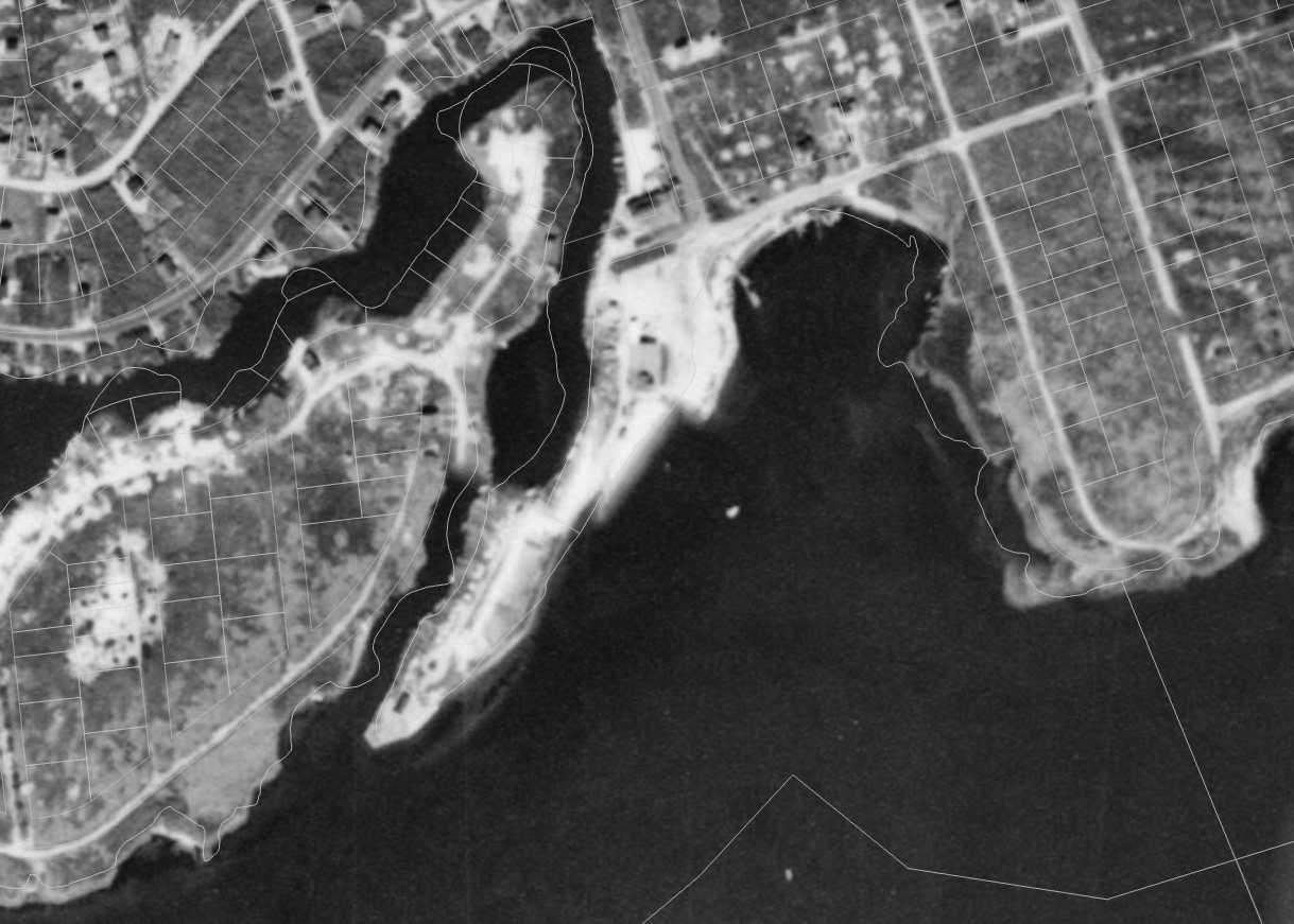
1947 Historical Aerial
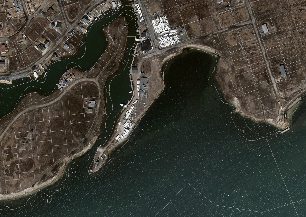
2020 Aerial (Pre-Demolition)
Picture of restaurant in the 1950's

Pictured above is Captain Andy’s fishing Station, which opened in the 1940s by Andrew Moscovicz. Located on Sheeps Pen Creek at the end of Cranberry Drive in Mastic Beach. It later became the former Violet Cove Restaurant in 2002, before closing sometime around 2008.
Picture source: https://mastichistory.wordpress.com/historic-sites/
Dilapidated Violet Cove Restaurant (2019)
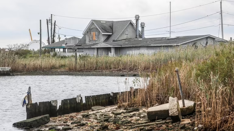
Picture source: https://www.newsday.com/long-island/suffolk/violet-s-cove-mastic-beach-marina-a87838
Demolition Video: https://abc7ny.com/mastic-beach-violet-cove-restaurant-long-island-superstorm-sandy/12024550/
Links
- Newsday articles:
September 2019: https://www.newsday.com/long-island/suffolk/violet-s-cove-mastic-beach-marina-a87838
July 2022: https://www.newsday.com/long-island/suffolk/violet-cove-restaurant-ecology-center-xmu07bk2


